Corporate
The Gallipoli Historical Underwater Park Project is an initiative launched to raise awareness about the Gallipoli Campaign. In line with this objective, the latest digital techniques have been employed to identify historically significant wrecks from the First World War in the Dardanelles Strait and the Aegean Sea. The project is an ongoing underwater archaeological research project that aims to help preserve the Gallipoli war wrecks for future generations.
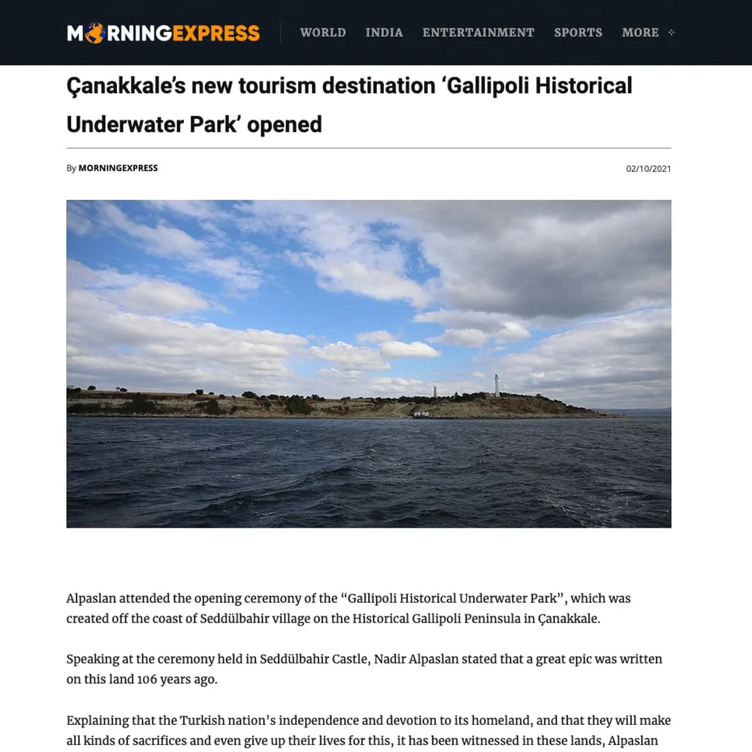
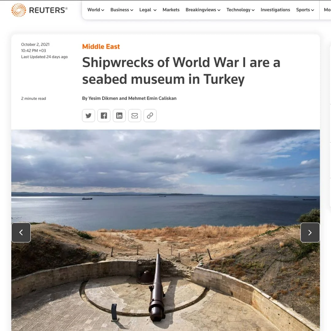
The Gallipoli Historical Area Directorate of the Gallipoli Campaigns was established in 2014 to protect the area where the Gallipoli Campaigns took place, to increase awareness of the Gallipoli Campaigns and to pass this knowledge on to future generations. It is listed on the UNESCO World Heritage Tentative List as the world's best-preserved battlefield. Just as the traces of the war on land have been preserved, the work that began in 2017 aims to identify the ships that sank during the Gallipoli Campaign, take protective measures, and open them to visitors.
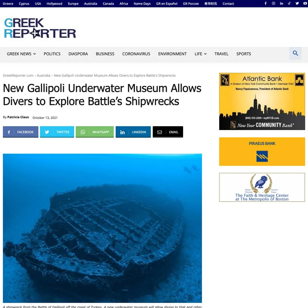
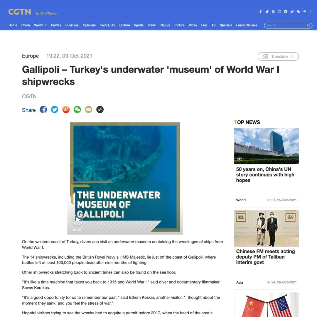
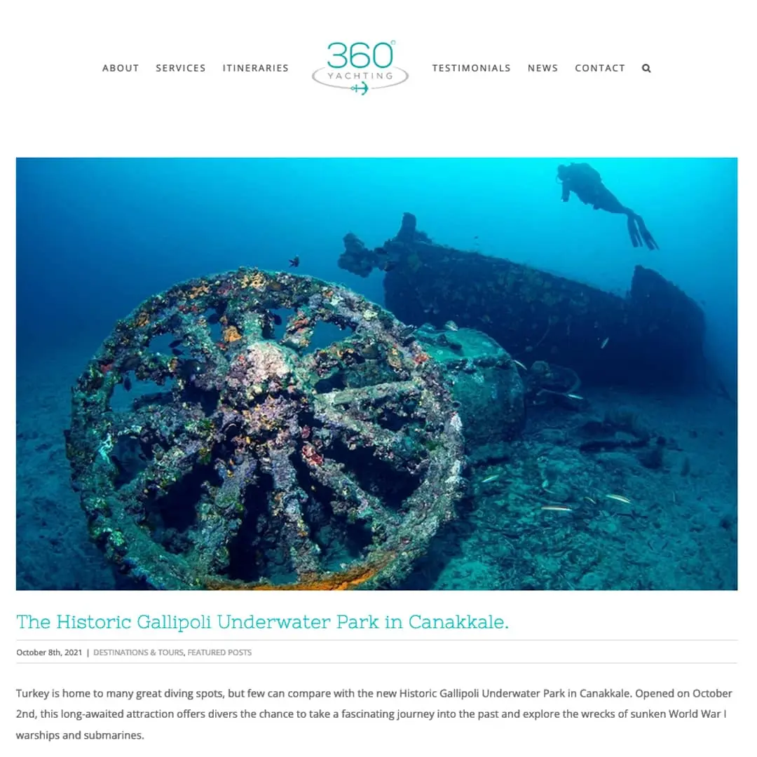
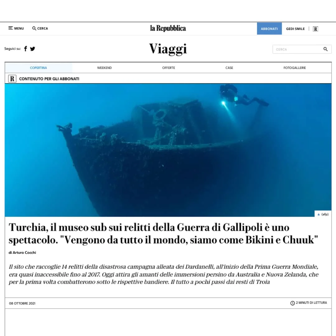
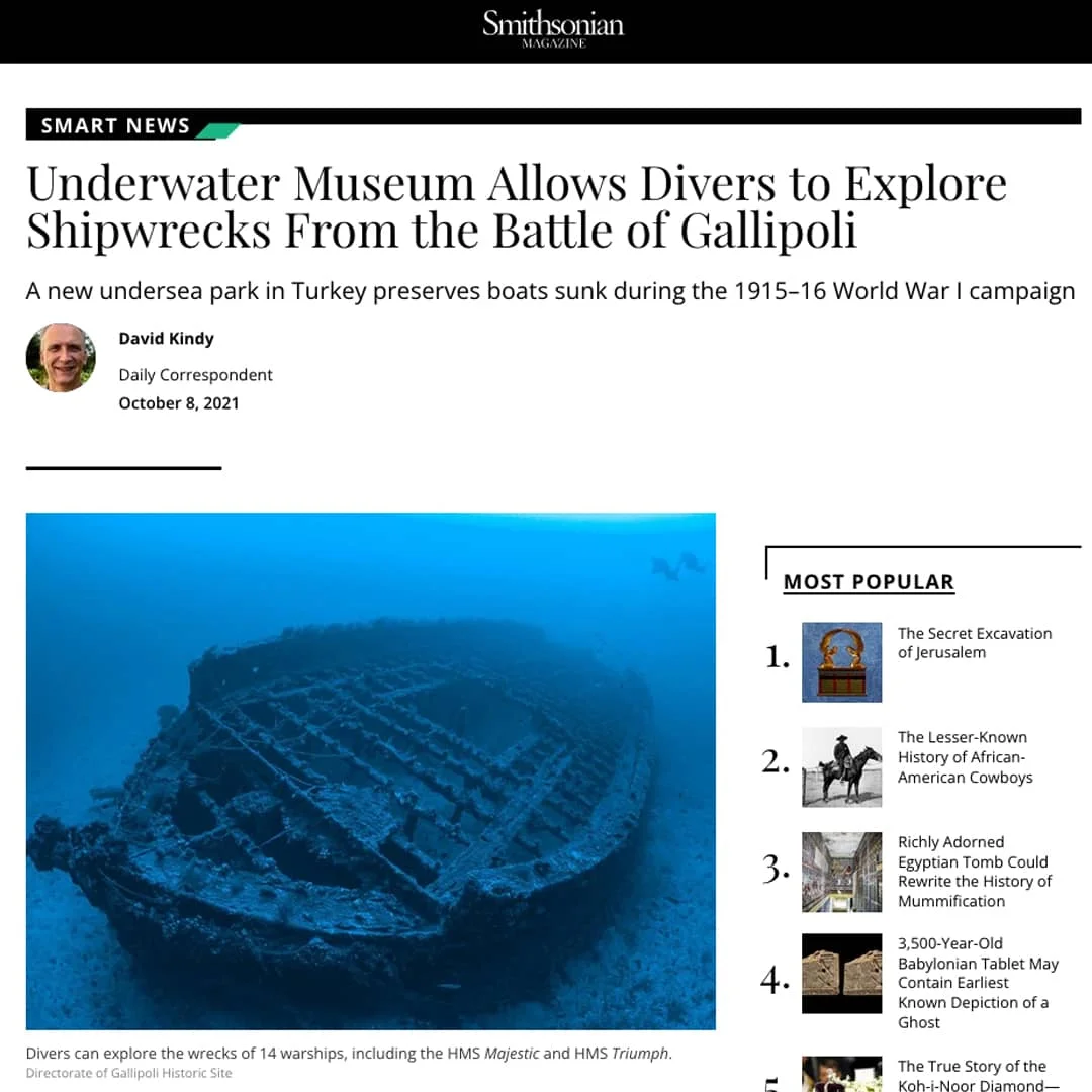
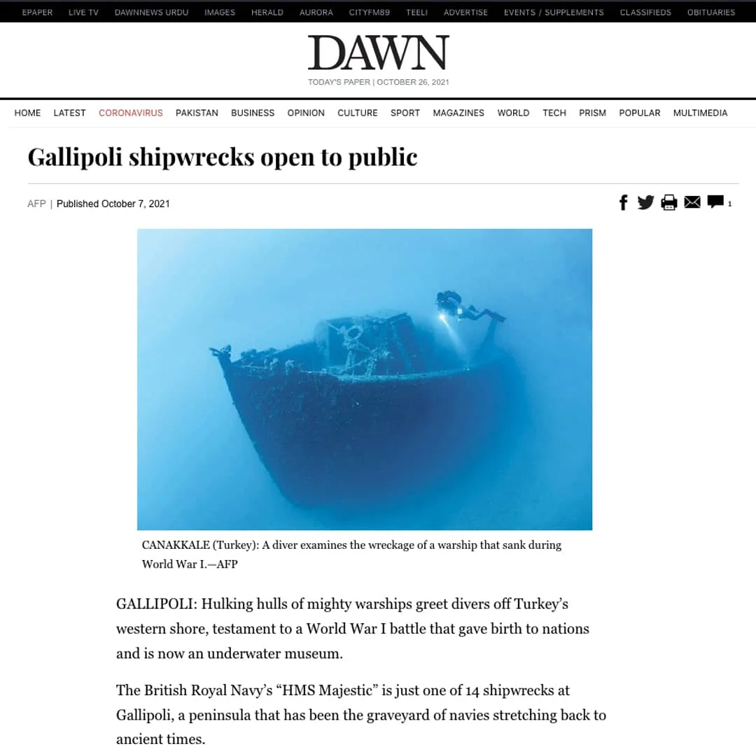
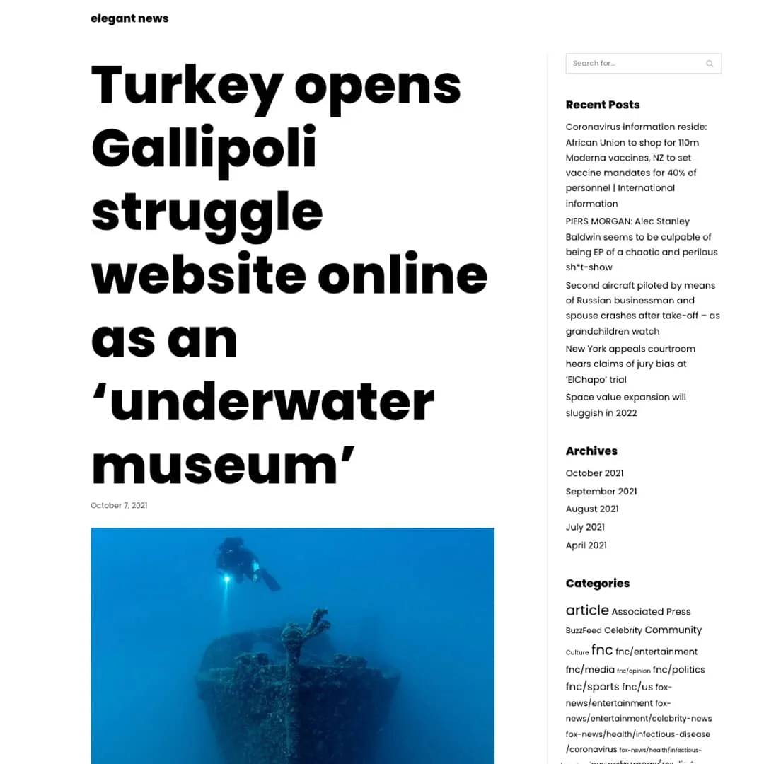
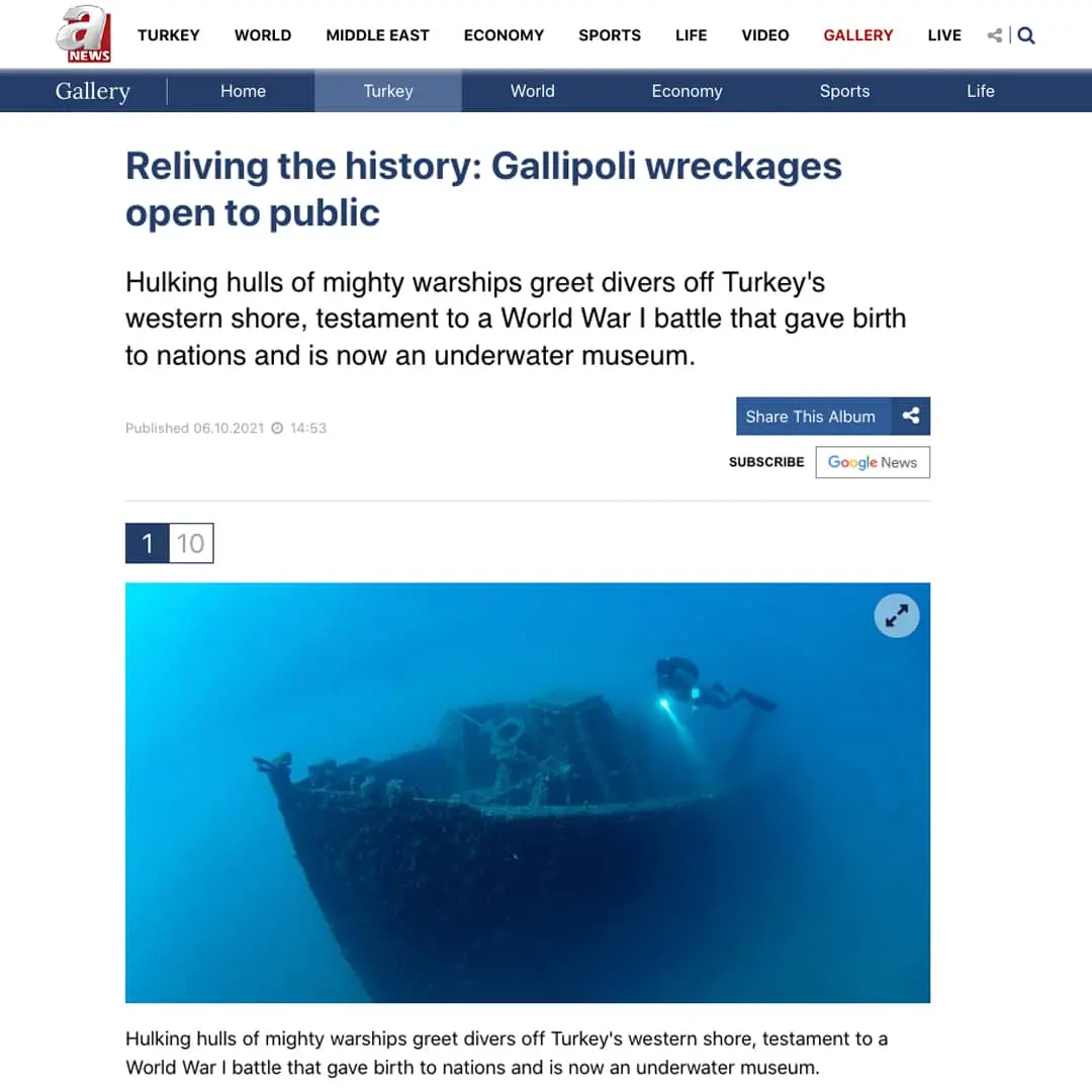
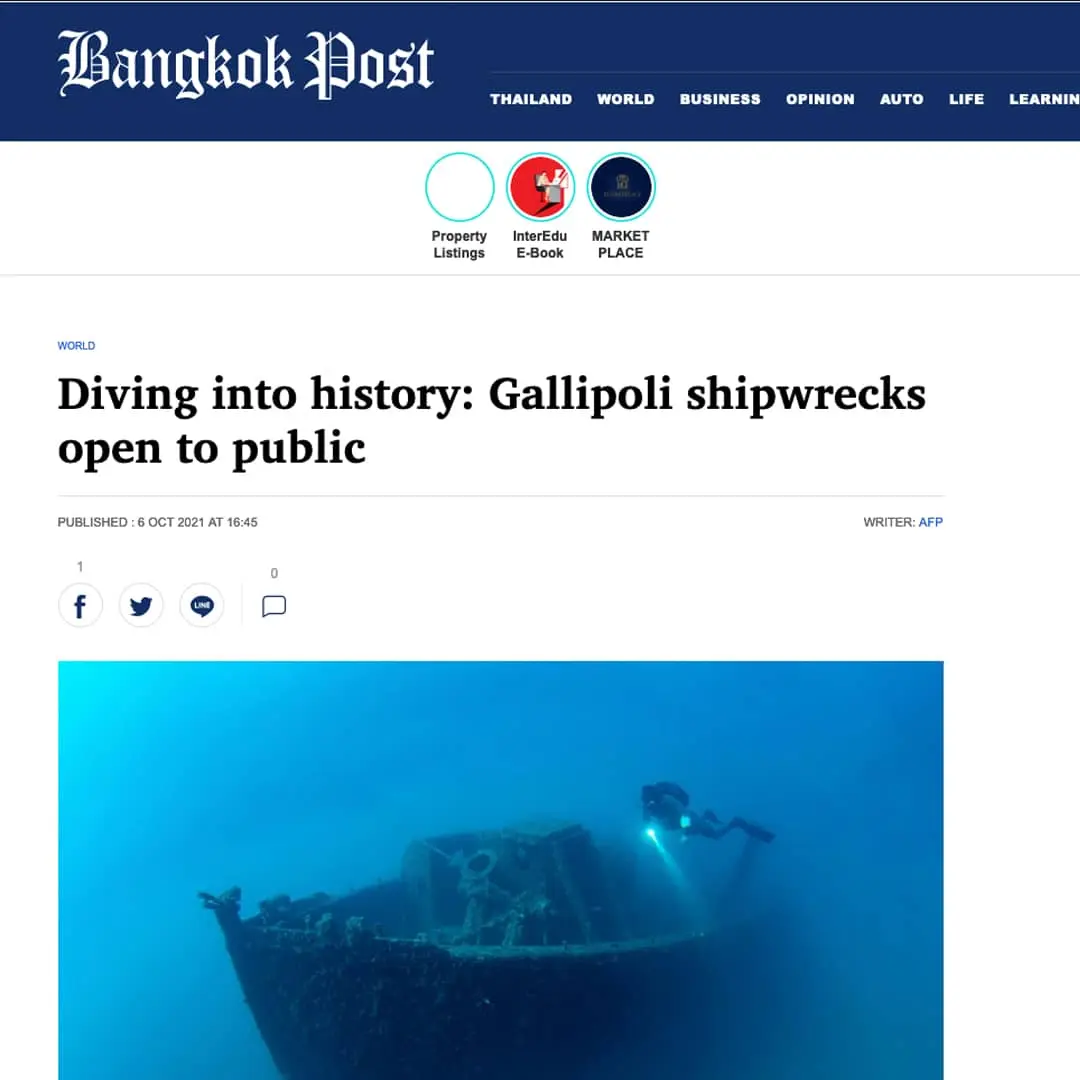
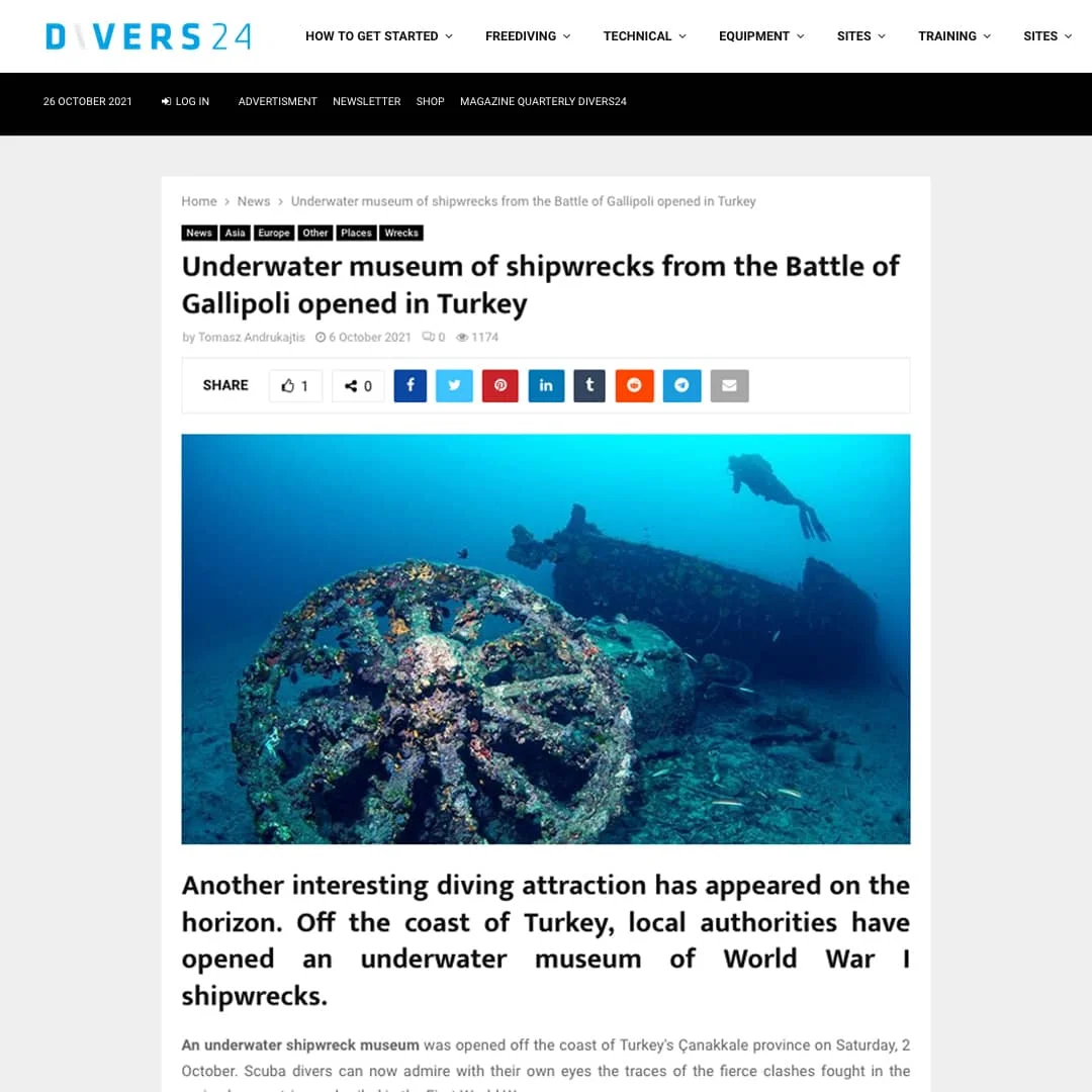
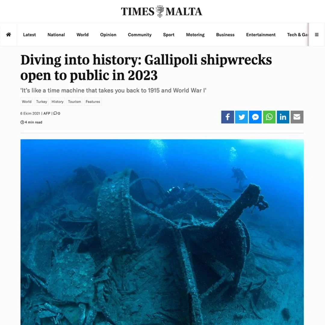
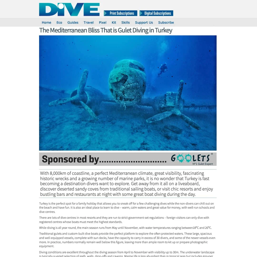
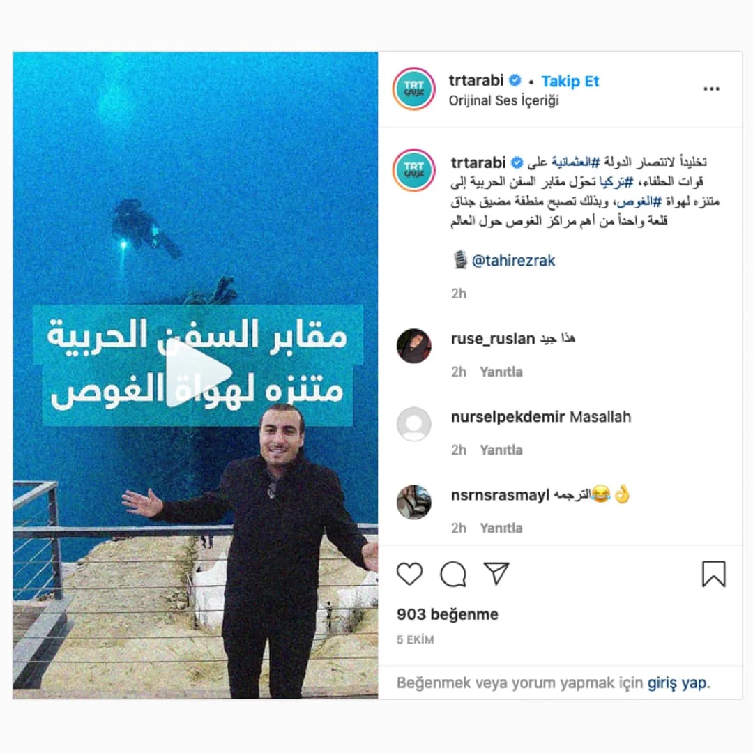
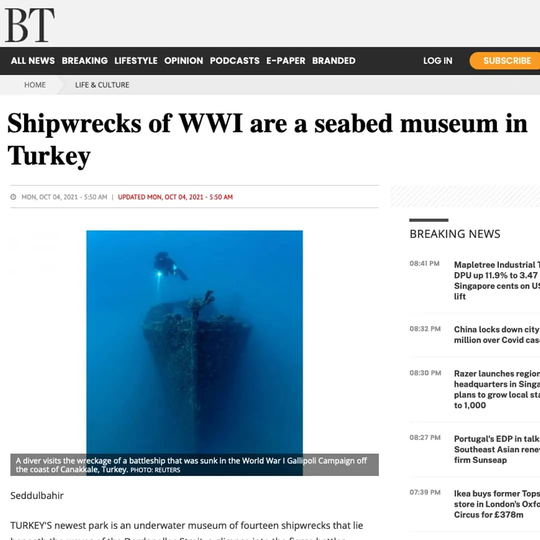
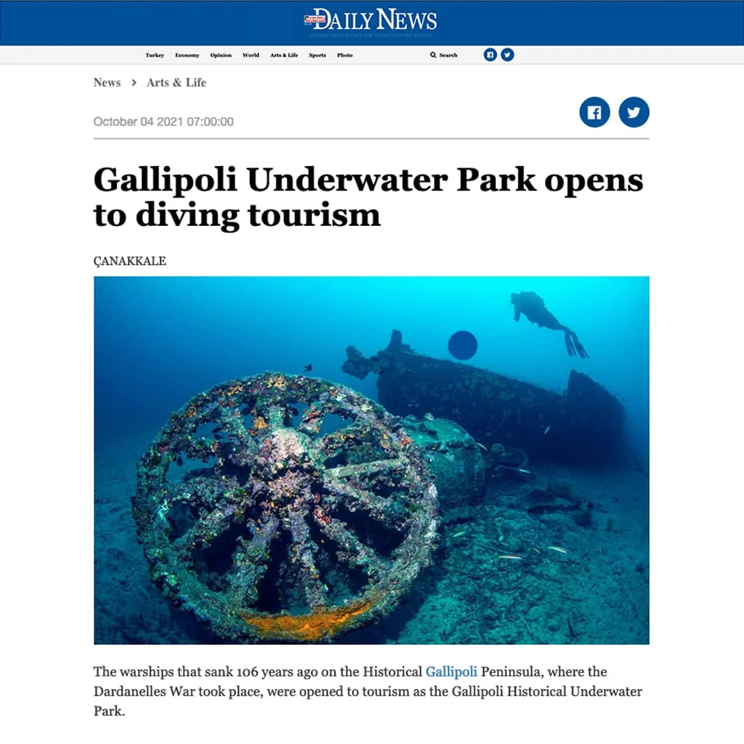
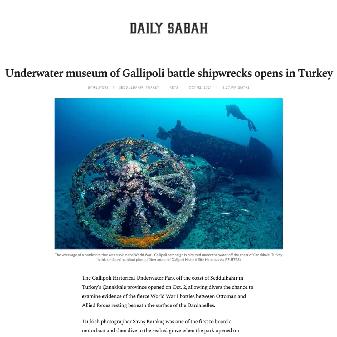
When one thinks of Çanakkale, the first thing that comes to mind is the epic struggle that took place on land on the Gallipoli Peninsula during the First World War. However, although one of the most important naval events of the First World War took place in Çanakkale, this fact is unknown to most people. Most people cannot access these underwater cultural heritage sites, which are war monuments frozen in time at the height of the war's violence and located at different depths in the sea.
Our Presidency is creating 3D maps and 3D applications that explain how the war wrecks lie on the seabed so that everyone can understand what is on the seabed, not just those who have the opportunity to dive.
Although the Gallipoli Campaigns are widely known, the ships that sank during the war and their stories are not well known, except to those who have the opportunity to dive with special permission. In addition to the opportunity to dive in the World War I-themed underwater park, where the stories of the war wrecks and what happened in Çanakkale are told, the three-dimensional views of the wrecks and their stories can also be seen. For these reasons, the Gallipoli Historical Underwater Park Project is one of the most important diving centres in the world.
The fact that the war wrecks have reached the present day underwater, both with their history and their final moments in the Battle of Gallipoli, and their stories based on technology and humanity, not only provide a wreck diving experience but also invite everyone who dives to feel the deep traces of the war.
We have always been conscious of the significance of the Gallipoli Campaigns, which altered the course of Turkish and world history, with each trench telling its own epic tale. We rolled up our sleeves to bring the wrecks that shed light on history and reflect the traces of that period in the most detailed manner to the world's attention, in a sense bringing historical information from beneath the water to the surface.
First and foremost, we aimed to proceed in the light of science and with the utmost sensitivity in every aspect. This aspect of history was of paramount importance, encompassing many civilisations and seeking to avoid hurting national sentiments and even to elevate them.
Our aim
was to ensure that the historical underwater heritage of Çanakkale gained worldwide recognition, thereby achieving the importance it deserves in both domestic and international tourism and becoming a globally recognised brand. Our main objectives were to ensure that these values, which have influenced the course of world history, are known to everyone and that the information revealed by scientific data is heard worldwide, by carrying out studies in accordance with the balance between conservation and use and in line with sustainable tourism balances.
What We Did
In line with all these objectives, we carried out joint studies with TÜBİTAK, the South Marmara Development Agency and Istanbul University. Our first step was to compile a list of ships that sank during World War I, followed by location identification studies using sonar and seismic mapping methods. By expanding the scope of our research in the 150 km² area we surveyed, we identified changes in the seabed from ancient times to the present day and located all shipwrecks from the same period to the present day.
At the same time, we conducted species identification studies for biodiversity analysis in the area, as well as studies to ensure the correct selection of equipment for diving safety. In this regard, we also carried out a comprehensive analysis of seasonal water temperatures and current directions and regimes. To obtain all this data and complete the project thoroughly in the light of science, we worked tirelessly with 25 pieces of technical equipment, ranging from seismic scanning systems to oceanographic cranes, side-scan sonars and GPS systems, and a team of more than 30 people.
To ensure diving safety and protect diving vessels from mooring problems caused by anchoring and hauling operations during wreck visits, we installed moorings and buoys at 16 diving points. This not only made diving operations safer and faster but also ensured that the wrecks would be preserved intact for future generations.
Research Conducted
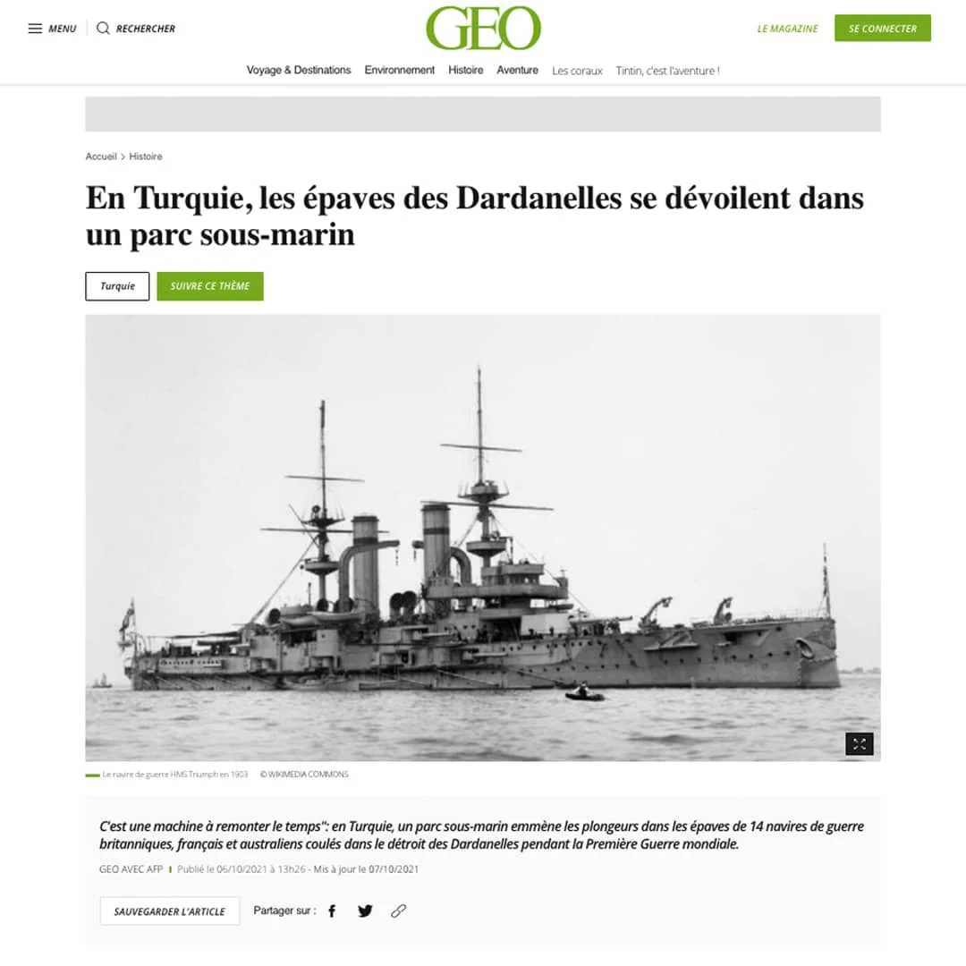
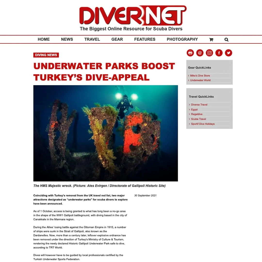
Aware of the importance of the results that would emerge in this context, we initiated the work processes that we had to carry out meticulously. In the first stage, we divided our working area into 7 sections along the coast, assigning number 1 to the area where the H.M.S. Majestic wreck is located. In all 7 sections, we used a multibeam echo sounder to measure shallow and deep depths in the first stage. In addition to depth and shallowness detection, we also carried out bathymetric surveys to map the contours, 3D and imagery of the wrecks. Following this work, we conducted oceanographic studies, including Side Scan Sonar Measurements, Sonar Mapping, and measurements of water currents and temperature balances. We successfully completed numerous technical details and high-resolution studies requiring intense attention, such as 3D Wreck Modelling Studies, Marine Flora and Fauna Observation Studies, Orthophoto Mapping Studies using Drones, Acoustic Diver Tracking System Studies, and finally Underwater Park Planning Studies, with great diligence and dedication, despite all the challenges posed by natural conditions.
What We Have Achieved
As a result of all these studies, 25 wrecks from World War I, 2 natural reefs with 43 different ecosystem varieties, 1 recent merchant ship wreck, and 1 wreck from ancient times were identified, adding 29 different diving sites to our country's historical and cultural treasures.
We have continued to increase our activities aimed at promoting these sites internationally. We have ensured their promotion on the international stage by regularly participating in the Boot Düsseldorf fair, which is considered a benchmark for the international boat and water sports industry and is held annually. We have secured our place at BalticTech 2024, recognised as the world's largest technical diving conference and held every two years in Gdynia, Poland, ensuring its promotion to interested parties on an international platform.
With the international underwater wreck photography competition we launched in 2025 under the name Gallipoli Wreck Fest, we succeeded in establishing our position in this field worldwide with our organisation involving competitors, participants and jury members from 18 different countries.
Conclusion and Acknowledgements
The underwater riches of Çanakkale Gelibolu, which are widely recognised for their importance in both our country's and world history, have thus taken their first steps towards becoming globally recognised values of our country's geography.